Portfolio
Army Welfare Housing Organization
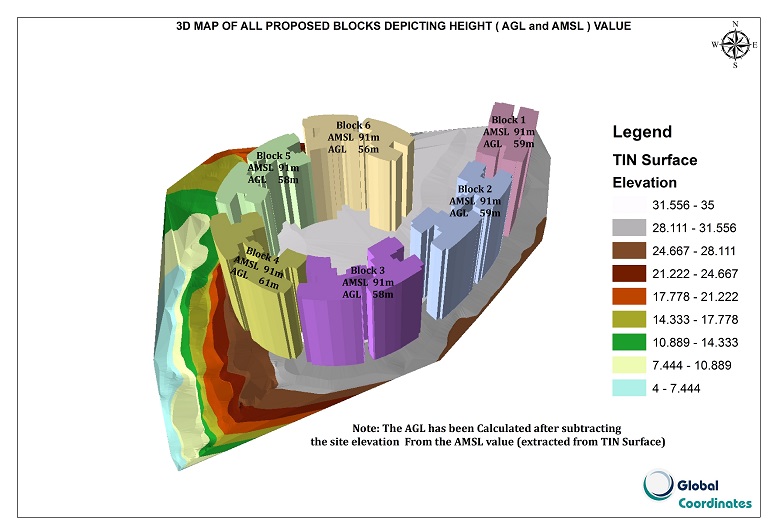
AWHO is a ‘No profit No loss’ organization with an aim to provide affordable housing for serving and retired soldiers and their widows. AWHO has acquired 7.45 acres of land at Alathara, Thiruvananthapuram, and approximately 6.0 Km from the Airport. In this project, the greatest challenge was the undulating terrain and the circular layout of the proposed buildings around the peak point in the site. A TIN surface was created over which the block boundaries were overlaid to extract the correct coordinates and site elevations. By conducting exact permissible height analysis using GSR 751 ( E), 91m AMSL was approved by AAI.
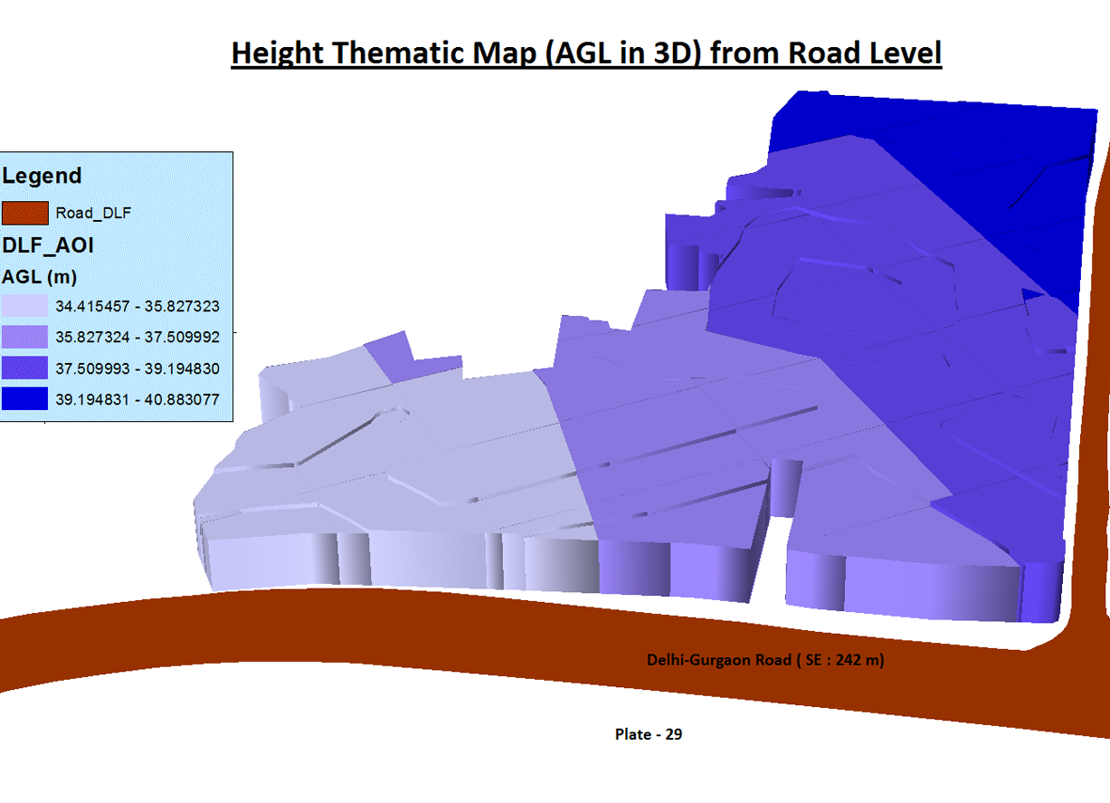
DLF City Centre Limited
DLF India mall Site is located in Delhi - Gurgaon Highway Road. The proposed site was divided into four equal site elevation groups based on the TIN surface generated by using surveyed contours. Permissible height analysis was carried out based on S.O.84 ( E) Guidelines issued by MOCA. In this project most restricted parameter for Hmax was the Radar below the 3rd runway at the Indra Gandhi International Airport.
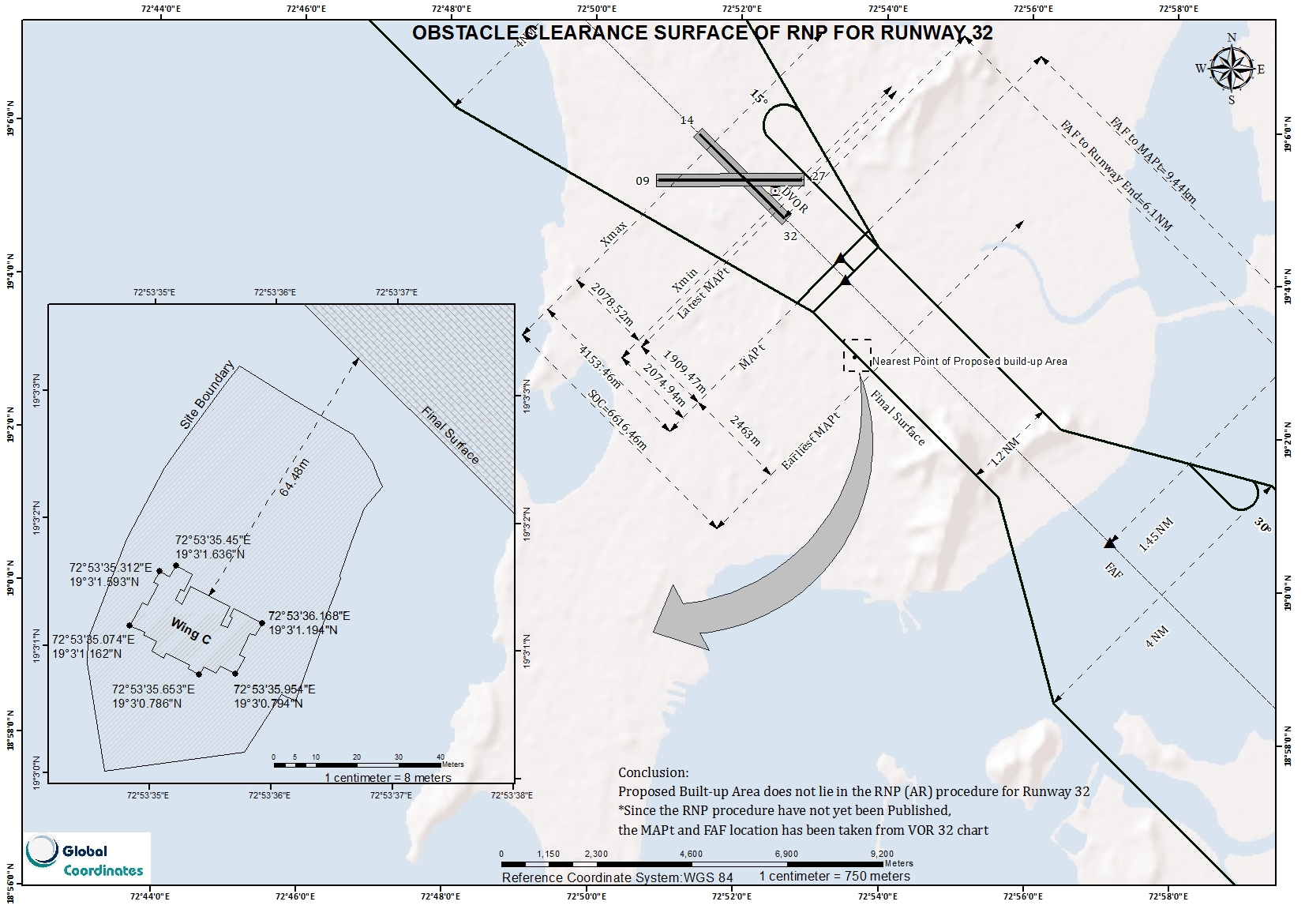
M/s Kukreja Constructions Company
The proposed construction at ‘Chandiram’ site required a height of 82m AMSL for justifying the FSI allotted. Permissible height analysis was carried out using AGA, CNS and PANS OPS criteria as laid out in the Guidelines issued by MOCA. The initial study had to be re-done as it became known that the proposed PBN procedures were also to be checked. This was a difficult task since the built up areas was just meters away from the proposed RNP procedure from Runway 32.
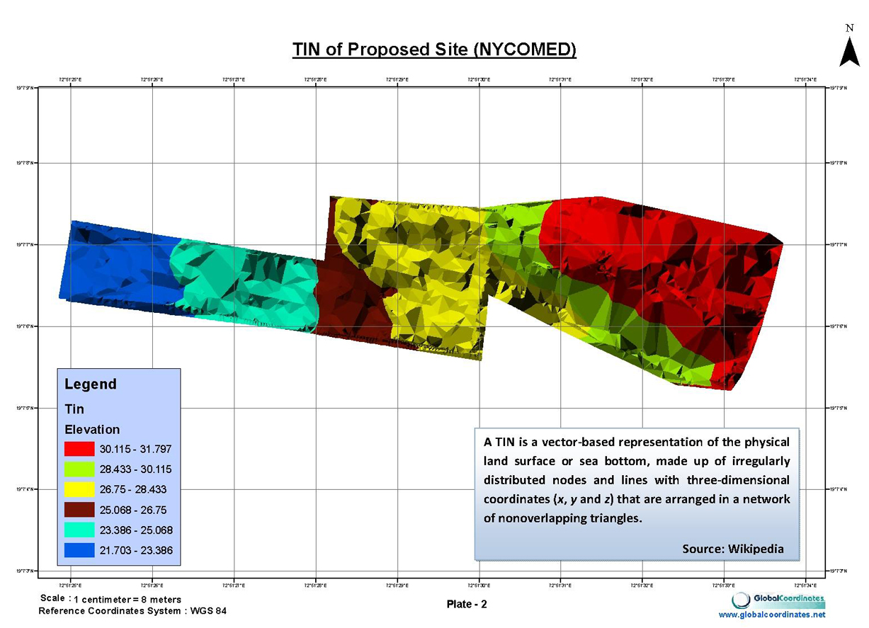
Mahindra Life Space Developers Ltd. (Nycomed)
The challenge of Nycomed was that it had 56 trees in the plot. Keeping in view the Maharashtra Tree and Preservation of Trees Act 1975, these trees could not be cut. They either had to be retained or transplanted according to the local Authorities. To save them, the only choice to execute the project was to go vertical. Also Basalt rock was encountered at a depth of 3m, it could not be excavated using conventional methods. Hence underground construction of a basement was also not possible. A Top Elevation value of 73.92 m AMSL for the residential Wings B1, B2, B3 and B4 has been checked for any impact on the PANS-OPS criteria or the safety and regularity of the aircraft and it can be safely declared that an obstacle of this height does not cause any deterioration of the prescribed OCA/H values. A Top Elevation value of 76.27 m AMSL for the parking area has been checked for any impact on the PANS-OPS criteria or the safety and regularity of the aircraft and it can be safely declared that an obstacle of this height does not cause any deterioration of the prescribed OCA/H values.
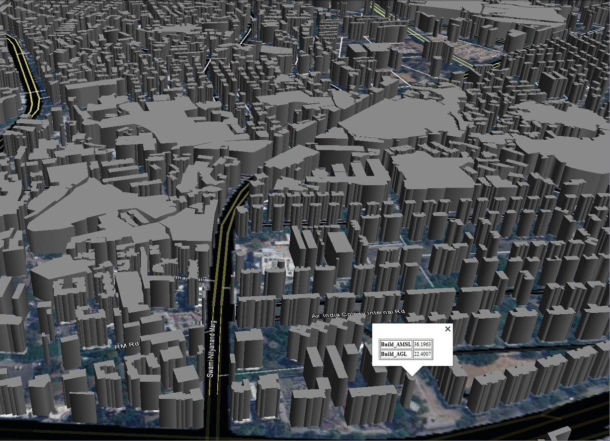
3D Building_extracted from Stereo Pair
We have procured stereo satellite imagery for a pilot area within I HS ( 4000m from all runway extremities) and extracted the x,y,z of all existing buildings to capture the scenario as on the collection date of the satellite image. Following the creation of the building database in real earth coordinates in 2D and 3D, we have run a spatial query to select all buildings with AMSL > 56.90m, basically all building which are penetrating the I HS. This gives us birds’ eye view of the current situation based on which future benchmarks could be set/re-set. In this accurate 3D database with a vertical and horizontal accuracy of 1m, we have also added the following layers Contours
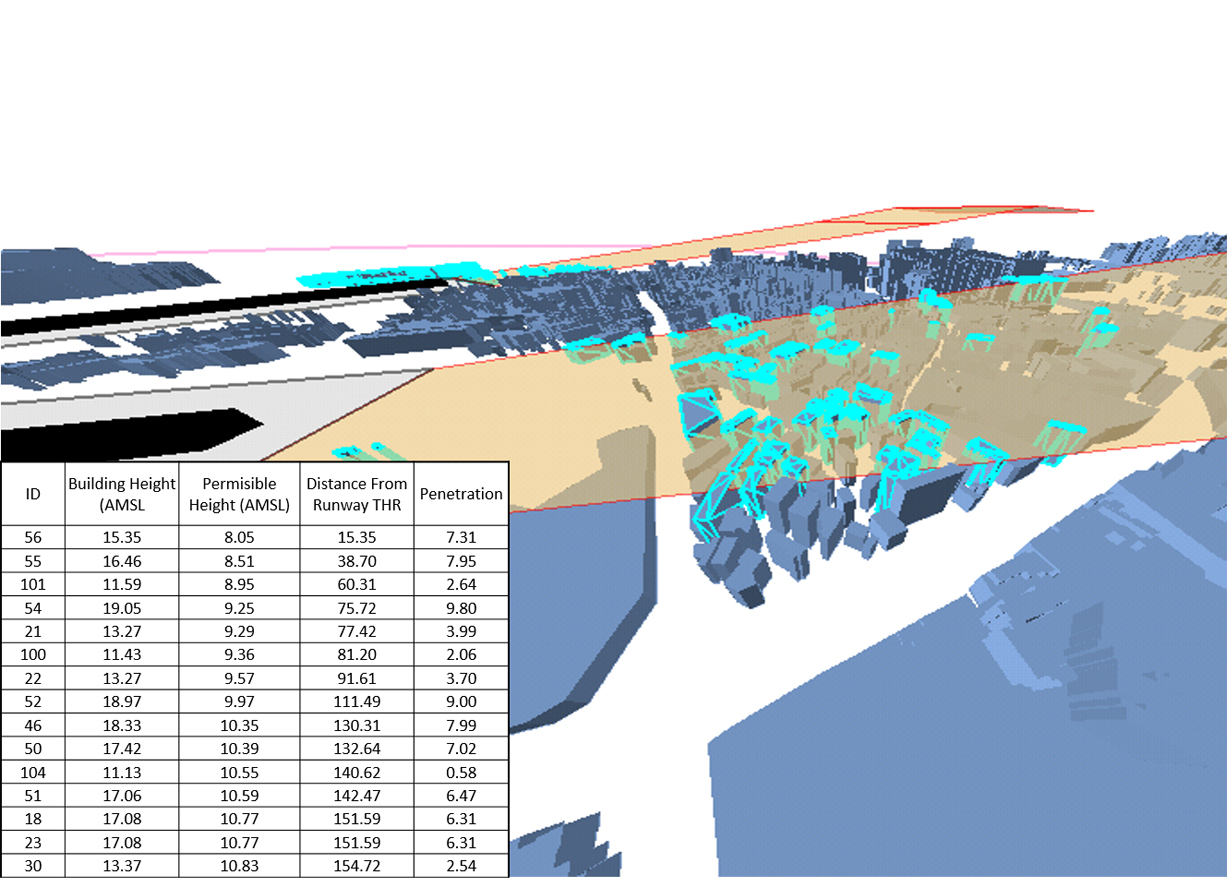
Identification of Buildings penetrating the Approach Surface using GIS
By using high resolution stereo satellite imagery and the technology of photogrammetry, all the obstacles/buildings penetrating the Approach Surface can be identified with their latitude, longitude and height above mean sea level in one click rendering the physical survey redundant, thus saving time, money and resources. This would also help in identifying the unauthorized buildings live