Creation of TOD based on Sec 5.3.3.4.5, CAR Series I Part I by DGCA
TOD for Santa Cruz Aerodrome through data mining
Global Coordinates has created TOD through data mining from all the revised NOC’s issued for enhanced height through Aeronautical Studies for Santa Cruz and Juhu Aerodrome in the years 2018,2019, 2020, 2021 as well as the obstacles published in the AIP. Since an Aeronautical Study is only carried out when a proposed structure penetrates the OLS, all such structures/buildings qualify for being part of the obstacle database as stated in Sec 5.3.3.4.5, CAR Series I Part I. All the NOC’s for which enhanced height has been granted through the process of Appeal and Aeronautical Studies as published in the MOM of the Appeal Committee as well as the AIP have been collected and plotted in a GIS environment. The digital data thus created has been overlaid on Cartosat-3 Mx geo-referenced satellite imagery with a resolution of 1.12m.
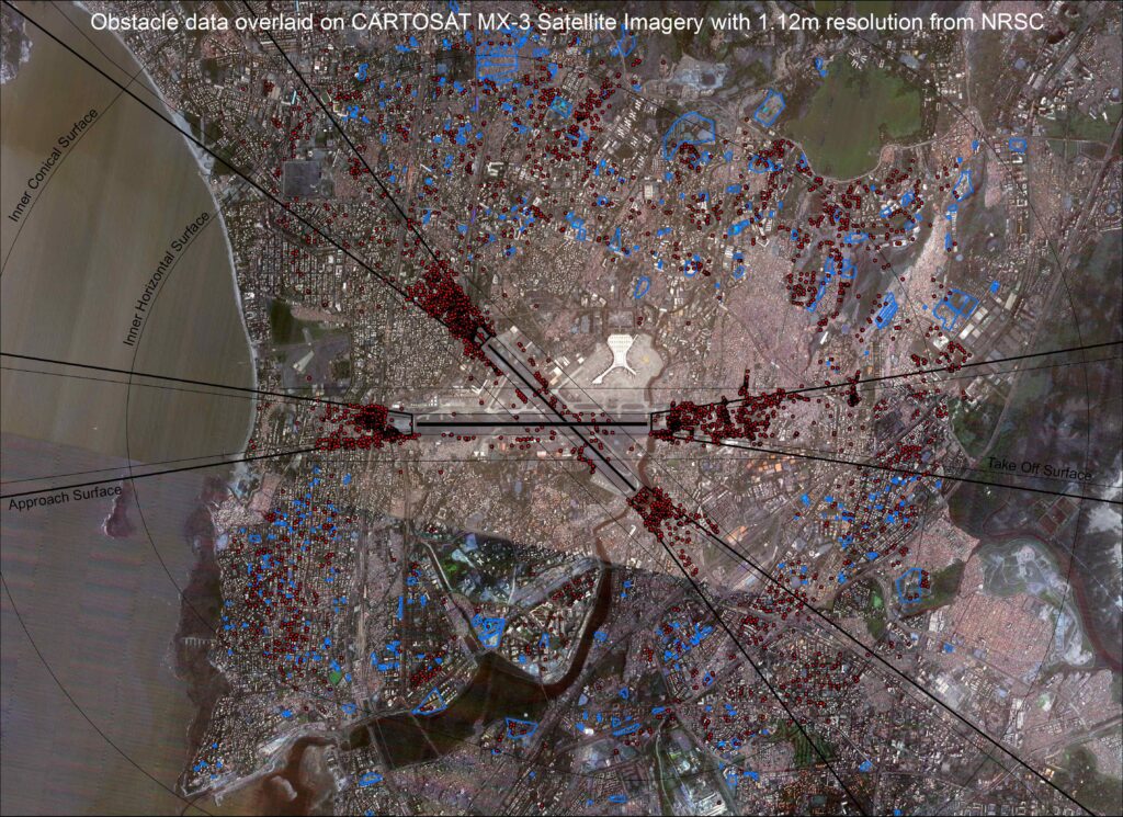
All visible building footprints have also been captured. The distance of the nearest coordinate of each NOC polygon / Obstacle listed in the AIP has been calculated from the Runway end as well as Runway strip to calculate the penetration of the OLS surface and the TOD Obstacle collection surface. All this data has been tabulated and linked to the NOC polygons / Obstacles published in the AIP. This meets the requirement of TOD as required by CAR Series I Part I. The layers of digital data created as per TOD requirements are as follows:
1. Santa Cruz Aerodrome dataset
2. Juhu Aerodrome dataset
3. Cartosat-3 Mx geo-referenced satellite imagery with a resolution of 1.12m covering the OLS surfaces + Area 2c
4. Contours ( Terrain )
5. AIP TOD dataset
6. Appeal TOD dataset
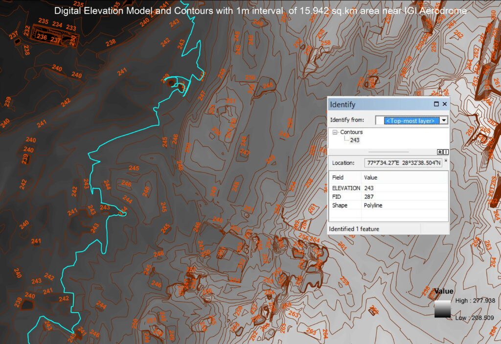
TOD through use of Photogrammetry/GIS/Remote Sensing technologies for a pilot area of 16 sq.km for DIAL.
High Rise buildings penetrating the Annexure 14 surfaces (specifically in the Approach Funnel and IHS) affect air safety if not properly controlled. It is observed that monitoring and surveillance of obstacles for ensuring flight safety and taking up possible/existing violations of the NOC issued by AAI, an accurate digital 2D-3D database of obstacles around the Aerodrome needs to be created and updated at regular intervals based on Sec 5.3.3.4.5, CAR Series I Part I by DGCA Global Coordinates procured Pleiades stereo satellite imagery ( 50cm resolution)
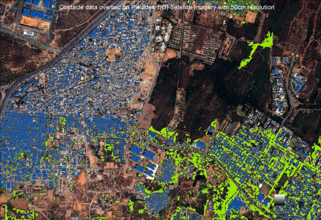
for a pilot area of 16 sq.km defined by DIAL and extracted all the obstacles and DEM
within the AOI to capture the scenario as available on the collection date of the satellite imagery. Following the creation of the obstacle database in real earth coordinates in 2D and 3D, DIAL checked the authenticity of the data on ground and could also select all buildings penetrating the OLS. This gives an intelligent birds’ eye view of the current situation and the digital data can be updated periodically in a relatively short time with less investment compared to a manual survey.